
Salt Lake City Travel Guide: Plan Your Utah Trip
Plan a trip to Salt Lake City with specific costs, transport routes, and district guides. Find the best months for skiing or hiking and common mistakes to avoid.
By the Journey Planner editorial team · Published 12 October 2026
Quick answer
Salt Lake City requires 3 to 4 days for a city-focused trip, or 7 days if including the Cottonwood Canyon ski resorts. Visit between December and March for skiing or September to October for hiking in Big Cottonwood Canyon. Budget $180 to $250 USD per day for a mid-range experience including a hotel near Temple Square and dining in 9th & 9th. The biggest planning mistake is underestimating the 1,300-metre altitude, which causes rapid dehydration and increased alcohol sensitivity.
Layout and districts
Salt Lake City is organised on a grid system originating from Temple Square. The numbers increase by 100 for every block away from the centre.
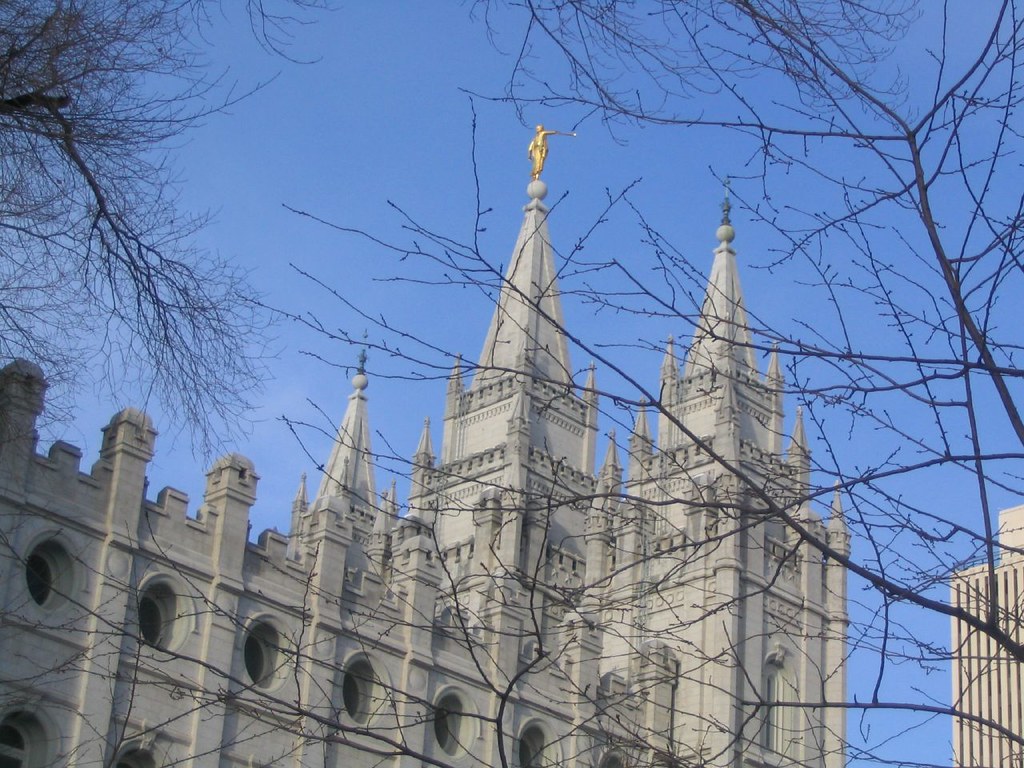
- Downtown: Best for first-time visitors and those without a car. It contains Temple Square, the City Creek Center shopping complex, and the Salt Palace Convention Center. The Blue and Green Trax light rail lines provide free transit within the downtown 'Free Fare Zone'.
- Sugar House: Suited to younger travellers and families seeking a local atmosphere. Located roughly 10 minutes southeast of downtown by car, it features Sugar House Park and a density of independent breweries and boutiques along 2100 South.
- 9th & 9th: A compact, walkable intersection ideal for food-focused travellers. It is home to the Tower Theatre and numerous high-end cafes.
- The Avenues: A historic residential hillside district with steep streets. It offers Victorian architecture and proximity to the City Creek Canyon trailheads, best for those seeking quiet stays and views of the valley.
- University / Foothill: Located on the eastern bench, this area houses the University of Utah, the Natural History Museum of Utah, and Red Butte Garden. It is higher in elevation and slightly cooler in summer.
How long to spend
- 2-3 Days: Focus on the urban core. Spend day one at Temple Square and the Utah State Capitol. Use day two for the Natural History Museum and a walk through Liberty Park. Spend the final morning at the Great Salt Lake State Park (a 20-minute drive west).
- 4-5 Days: Incorporate outdoor recreation. Add a full day for hiking the Living Room Trail or mountain biking in Park City (40 minutes away). Visit the Antelope Island State Park to see bison and the best views of the lake.
- 7+ Days: Necessary for a winter ski trip. This allows for four days on the slopes at Alta, Snowbird, Solitude, or Brighton, plus rest days to explore the downtown dining scene.
When to go
| Season | Months | Average High | Notes |
|---|---|---|---|
| Winter | Dec - Feb | 3°C - 7°C | Peak ski season; expect higher hotel rates and 'inversion' smog in the valley. |
| Spring | Mar - May | 12°C - 22° | Variable weather; hiking trails at lower elevations begin to clear in late April. |
| Summer | Jun - Aug | 28°C - 34°C | Hot and dry; best for high-altitude hiking where temperatures are 10 degrees cooler. |
| Autumn | Sep - Nov | 10°C - 26°C | Best hiking conditions; fall foliage peaks in the canyons in late September. |
Approximate costs
Prices are estimates; check official sites before you go.
- Accommodation: A mid-range hotel downtown costs $150–$220 USD per night. Budget hostels or basic motels near the airport start around $90 USD.
- Food: A casual meal at a taqueria or deli costs $12–$18 USD. A three-course dinner for two in a mid-range restaurant costs approximately $80–$120 USD excluding alcohol.
- Transport: A one-way adult fare on the Trax light rail or bus is $2.50 USD. A Day Pass is $5.00 USD.
- Attractions: Many sites like Temple Square and the State Capitol are free. The Natural History Museum of Utah is approximately $20 USD. A lift ticket at a nearby ski resort ranges from $120 to $280 USD depending on the date and resort.
Getting there and around
Salt Lake City International Airport (SLC) is a major Delta hub located 10 minutes west of downtown. The Green Line Trax light rail runs directly from the airport terminal to the city centre every 15 minutes on weekdays and 20 minutes on weekends. The journey takes approximately 20 minutes and costs $2.50 USD.
For getting around the city, the Trax system is efficient for north-south travel. The Blue Line connects downtown to the suburbs, while the Red Line goes to the University. Within the downtown 'Free Fare Zone' (bounded by 400 South, North Temple, 200 East, and 600 West), you do not need to pay or tap a card to ride Trax or buses.
If you plan to visit the Cottonwood Canyons or Antelope Island, a rental car is recommended. Ride-share services like Uber and Lyft are widely available, but fares to ski resorts can exceed $60 USD each way during peak times.
Where to base yourself
If you do not have a car, stay within two blocks of Main Street between South Temple and 400 South. This provides walking access to the majority of transit lines and the highest concentration of restaurants. For a quieter, more residential experience, look for rentals in Sugar House near the S-Line streetcar. Avoid staying directly next to the airport unless you have a very early flight, as there are limited dining and sightseeing options in that industrial area.
Food and etiquette
Salt Lake City has specific liquor laws. While you can buy beer (up to 5% ABV) in grocery stores, wine and heavy spirits are only sold in state-run liquor stores, which are closed on Sundays and public holidays. In restaurants, you must order food if you are in a 'Dining Club' licensed establishment to be served alcohol. Tipping is standard at 18-20% for table service.
Local specialities include 'fry sauce' (a mix of mayonnaise and ketchup served with chips) and 'pastrami burgers'. The city has a significant Hispanic population, resulting in high-quality taco tracks, particularly along State Street.
Safety and practicalities
The city is generally safe for travellers, though like any urban centre, the area around Pioneer Park and the Rio Grande district can have a high population of people experiencing homelessness; exercise standard awareness. The primary safety concern is the environment. The sun is intense at high altitudes; wear SPF 30+ even in winter. If hiking, carry more water than you think you need, as the humidity is extremely low.
Common mistakes
- Skiing without a reservation: Many resorts now require parking reservations or have capped ticket sales. Check the individual resort website weeks in advance.
- Sunday closures: Many local restaurants and shops, particularly in the suburbs, close on Sundays. Downtown franchises and larger malls usually remain open.
- Miscalculating the Great Salt Lake: The lake is very shallow and receding. Accessing the water for a 'float' requires a 20-40 minute drive to Antelope Island or the State Park; you cannot see it effectively from the city centre.
- Ignoring the 'Free Fare Zone': Many tourists buy day passes when they only intend to travel within the six-block downtown radius where transport is free.
Plan your trip
Journey Planner turns this guide into a personalised day-by-day itinerary for your dates and group. You get monthly weather for your travel month, estimated flight, hotel and attraction costs in your currency, outfit ideas and a packing list for the season — free, no login required.
For more specific details, see our deeper guides on the best time to visit, regional costs, and the 4-day Salt Lake City itinerary.
Prices, opening hours and transport times in this guide are estimates used for planning and can change with season and operator. Check official sites before you book.
More Salt Lake City guides
- First-time visitor guideSalt Lake City for First-Time Visitors: Essential Guide
- ItinerarySalt Lake City Itinerary: 7-Day Utah Travel Guide
- ItinerarySalt Lake City Itinerary: 3 Days in the Crossroads of the West
- ItinerarySalt Lake City Itinerary: 5 Days in the Wasatch Front
- Trip planner comparison5 Best Trip Planner Websites, Compared
- Trip planner comparison5 Best AI Trip Planner Websites and What They Actually Do Well
More planning help in the Salt Lake City travel guide, or browse all travel guides and itineraries.
Plan this trip in seconds
Turn this guide into a day-by-day itinerary with weather, costs and a packing list.
Plan My Salt Lake City TripAlready have an itinerary?
Check whether your plan is realistic: overloaded days, excessive travel time, inefficient routing, too much walking, opening-hour conflicts and poor geographic grouping.
Analyze My Itinerary